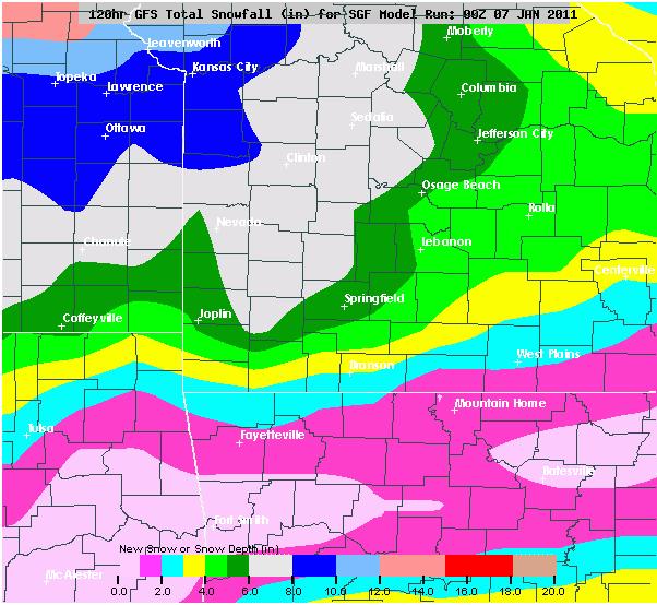
Here is the latest GFS model run forecast for Southwest Missouri:
Please keep in mind that the exact track of this storm is still uncertain and any variation of the track could increase or decrease snowfall amounts. Now, I am not anywhere close to being a meteorologist but I am currently forecasting the Low to track somewhere in the yellow, aqua or dark pink shaded areas. As this model indicates, the further north and west of Interstate 44 you go the deeper the snowfall amounts get. However, this is only half of the story. As the Low tracks east of the Springfield area, strong gusty north to northwest winds are expected behind this system which if I may add may produce blowing and drifting of the fallen snow (especially where the heavier bands of snow occur) as well as bitterly cold wind chills.
I will keep posting updates on this potentially significant winter storm as warranted.